Ozi Explorer

Supports GeoTiffs (DRGs)
Import ESRI shape files
Export waypoints to points and tracks to polylines and more!

Ozi Explorer Features
CAD $129.95
- Scan and calibrate your own maps or charts
- Supports Upload/Download of Events for Lowrance/Eagle GPS receivers
- Create Tracks on the map and upload to the GPS (Lowrance, Eagle, Garmin and Magellan), *not all GPS models support this function
- Specify permanent Map features and display a picture for each feature place symbols and comments on the Map, and print hardcopy
- Any GPS receiver which outputs NMEA 0183 sentences can be used for Moving Map (real time tracking) mode
- Numerous Grid systems, and Map Projections supported including UTM, BNG, IG, Swiss, Swedish, NZG + others, plus over 100 map Datums
- Print Maps and Waypoint Lists
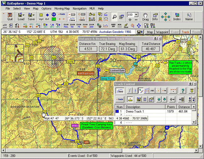
Screen Capture
Included: Map of Canada, the world, Vancouver Island, and the Yukon.
Click here for a visual explanation of OziExplorer's Additional Features.
Requirements
- Windows 7.0 32bit/64bit
- Windows 8.0/8.1 32/bit/64bit
- 8 MB of RAM
- VGA Monitor and Mouse
- CD-ROM drive
- Free Serial Port or USB port to connect to GPS
- GPS


